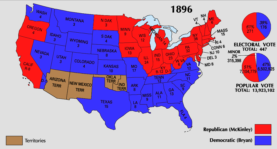
You can look at the electoral maps for all previous presidential elections at sites like this and this. The electoral map that bears the closest resemblance to the predictions for 2008 is 1896. And it is a pretty close resemblance. There is one small difference, though: the parties have flipped. The core of the Democratic party in 1896 was the South and the Interior West (the plains states west to Nevada, but not including California and Oregon). The rest of the country went to the Republicans. I'm not the first to note this inversion, and political scientists have competing arguments about its significance, but it is striking that the core of the Republican party is now the same area (South and Interior West) that once were the core of the Democrats.
Electoral Map: